

Background
According to Newton's law of gravitation, the gravity acceleration (or simply gravity) of a test mass is proportional to the mass of the Earth and the reciprocal squared distance between the two masses. The well-known value of gravity of 9.8 m/s² is only theoretically constant on the surface of our Earth, assuming a homogeneous sphere. In reality, gravity varies spatially from point to point, but also over time, although only from the sixth decimal place. Gravimetry is the measurement of gravity using gravimeters. If these measurements take place at earth-bound locations, they are referred to as terrestrial gravimetry.
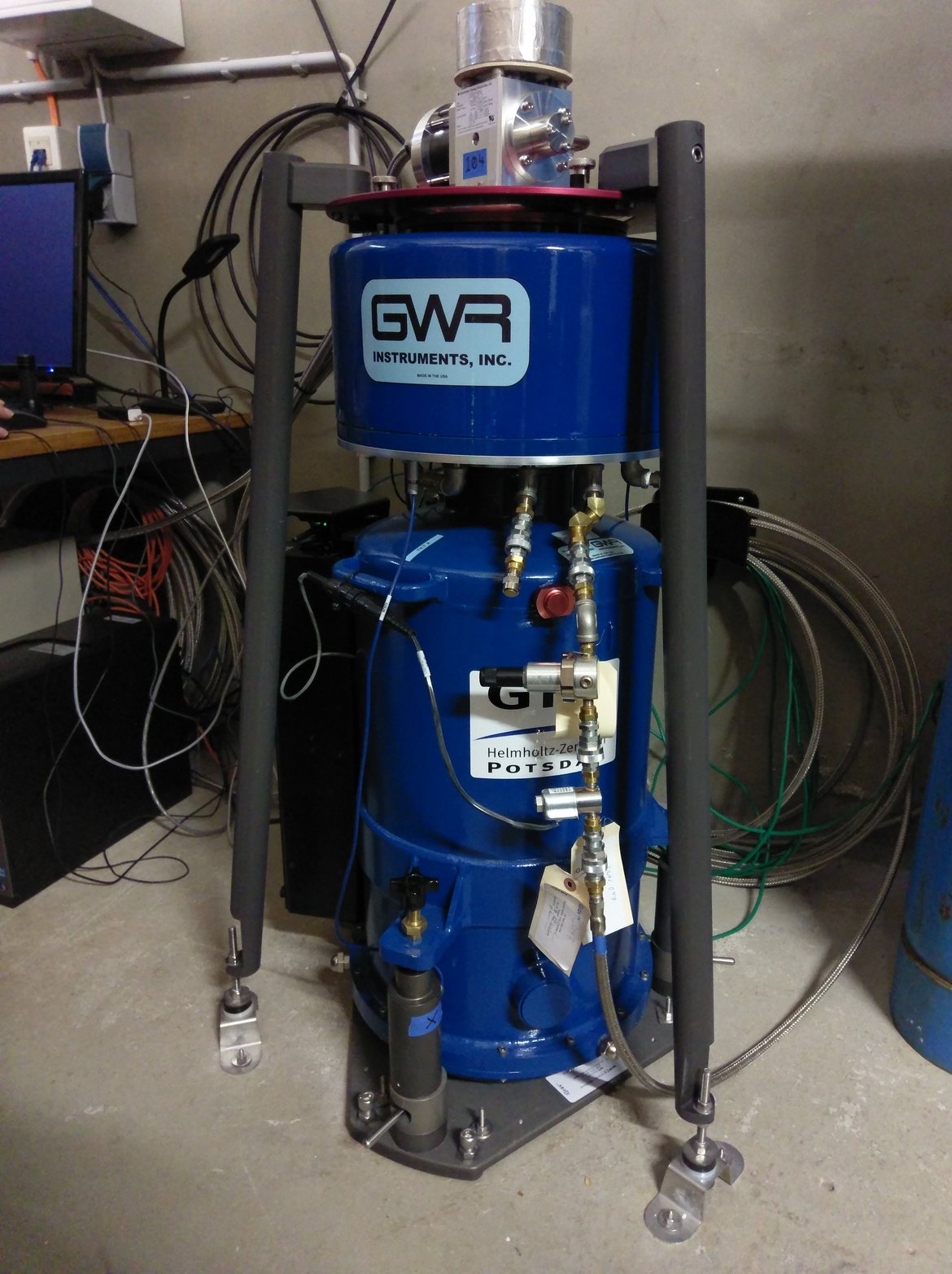
On the Telegrafenberg in Potsdam, terrestrial gravimetry has a long tradition. More than 100 years ago, pendulum measurements were used to determine the absolute value of gravity to a precision of 9.81274 m/s². A measuring pillar of the Geodetic Institute then became the World Gravity Reference Point and, until 1971, realised the ‘Potsdam Gravity System’ as the world reference system. Nowadays, superconducting gravimeters are used at the GFZ to measure the temporal variations of gravity at a single location continuously, with long-term stability and with the highest precision of 1 nm/s² (10-9 m/s²) and better. These point measurements are complemented by portable spring gravimeters, which are used to measure the transition to spatio-temporal variations.
Superconducting gravimeters are used for many geophysical and hydrological purposes. The signals of interest can occur on local to global scales, in temporal ranges from seconds to decades, and be of periodic or broadband nature. The non-trivial task at each location is to separate the desired signal from a single measurement per point in time for the totality of all gravity variations caused by mass variations and deformations in the Earth system, the Earth's rotation and the masses of the Sun and Moon.
Current topics at GFZ in the context of terrestrial gravimetry include the observation of temporal gravity variations induced by atmospheric, oceanic and hydrological mass redistributions and interactions with the solid Earth due to loading effects, as well as the validation and combination of satellite data from GRACE, GRACE-FO and successor missions with terrestrial data. Currently, data from 68 sensors at 48 stations worldwide are integrated as part of the IAG International Geodynamics and Earth Tide Service (IGETS). The GFZ operates the IGETS database and provides data from its three superconducting gravimeters.
The current locations of the superconducting gravimeters can be regarded as hot spots in Germany. At Zugspitze, the aim is to quantify the Alpine water balance and its climate-related changes. At Helgoland, tidal and non-tidal sea level variations and their interactions with the solid Earth are being investigated, which are also changing due to climate change. The superconducting gravimeter from Sutherland, South Africa, is currently being moved to the Volcanic Eifel region at Laacher See, where active seismic signals with strong local deformations are showing up.
Key scientific questions
- To what extent can terrestrial gravimetry, in combination with other observation techniques, contribute to an improved geophysical or hydrological process understanding?
- How well do state-of-the-art models for atmospheric, oceanic and hydrological mass redistributions agree with the high-precision gravimetric observations?
- How can we make the transition from point-based terrestrial gravimetry to regionally representative observations in order to bridge the gap to satellite gravimetry?
Related projects
