Hydrometeorological and Geodetic Network in Central Asia
Introduction
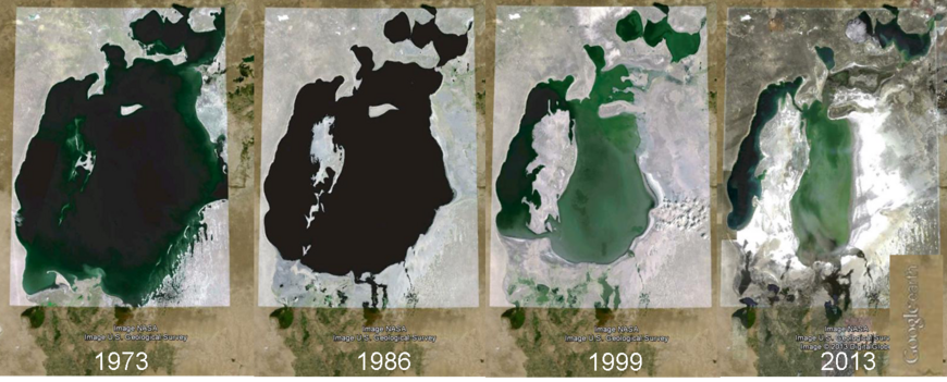
Water is an extremely important resource in Central Asia as the economy is strongly dependent on agricultural production and hydropower. During recent decades, the demand for water has significantly increased due to irrigation development and population growth. While the water of the two largest transboundary rivers are used for generating hydropower in the upstream countries, the downstream countries use huge amounts of the partially polluted water for irrigating agricultural areas. The ineffective use of water and local water policies have increased the shortage of water (since 2010 the Syr Darya river no longer reaches the Aral Sea) and lead to significant political and economical disputes in Central Asia.
The evaluation and estimation of the water balance system and the validation of climate change in this area help to develop strategies for a sustainable water resource management. The determination of meteorological and hydrological data at significant places is the foundation for further water usage policies.
Concept
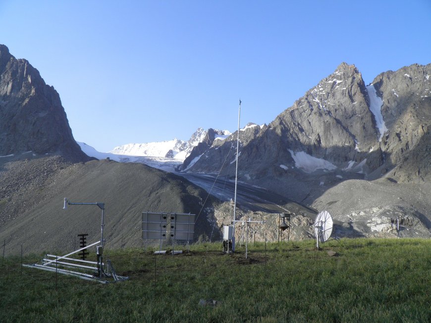
The installation of a modern infrastructure for acquisition and processing of hydrometeorological data is part of the CAWA – project (Central Asian Water). Remotely Operated Multi-Parameter Stations (ROMPS) are installed by GFZ in the Central Asian countries especially in remote areas. Different meteorological, hydrological (snow and discharge parameters) and GNSS data is continuously measured. The data is stored at the station and transmitted regularly to a central Sensor Data Storage System (SDSS) to provide the data to a wide user community.
The Network
The CAWa network consists of currently 12 active stations and further stations are planned. Beside the hydrometeorological sensors and the GNSS receiver, some stations are equipped with broadband seismometers (3), cameras (3), snow pack analyzing systems (4) and discharge monitoring systems (2).


