

Variability of water levels at the coasts and inland as measured by SWOT | Ready for SWOT
The core of the Surface Water and Ocean Topography (SWOT) mission launched in December 2022 is an innovative Ka-band radar interferometer that records water levels two-dimensionally along a 120 km wide swath during the overflight. The mission delivers different products for applications on the ocean and on land. In WG4, as members of the SWOT CalVal and SWOT Science Teams, we are involved in calibrating the new technology and exploring the possibilities for observing eddies in the open ocean, ocean dynamics near the coast and monitoring the continental water cycle.
SWOT over the Ocean
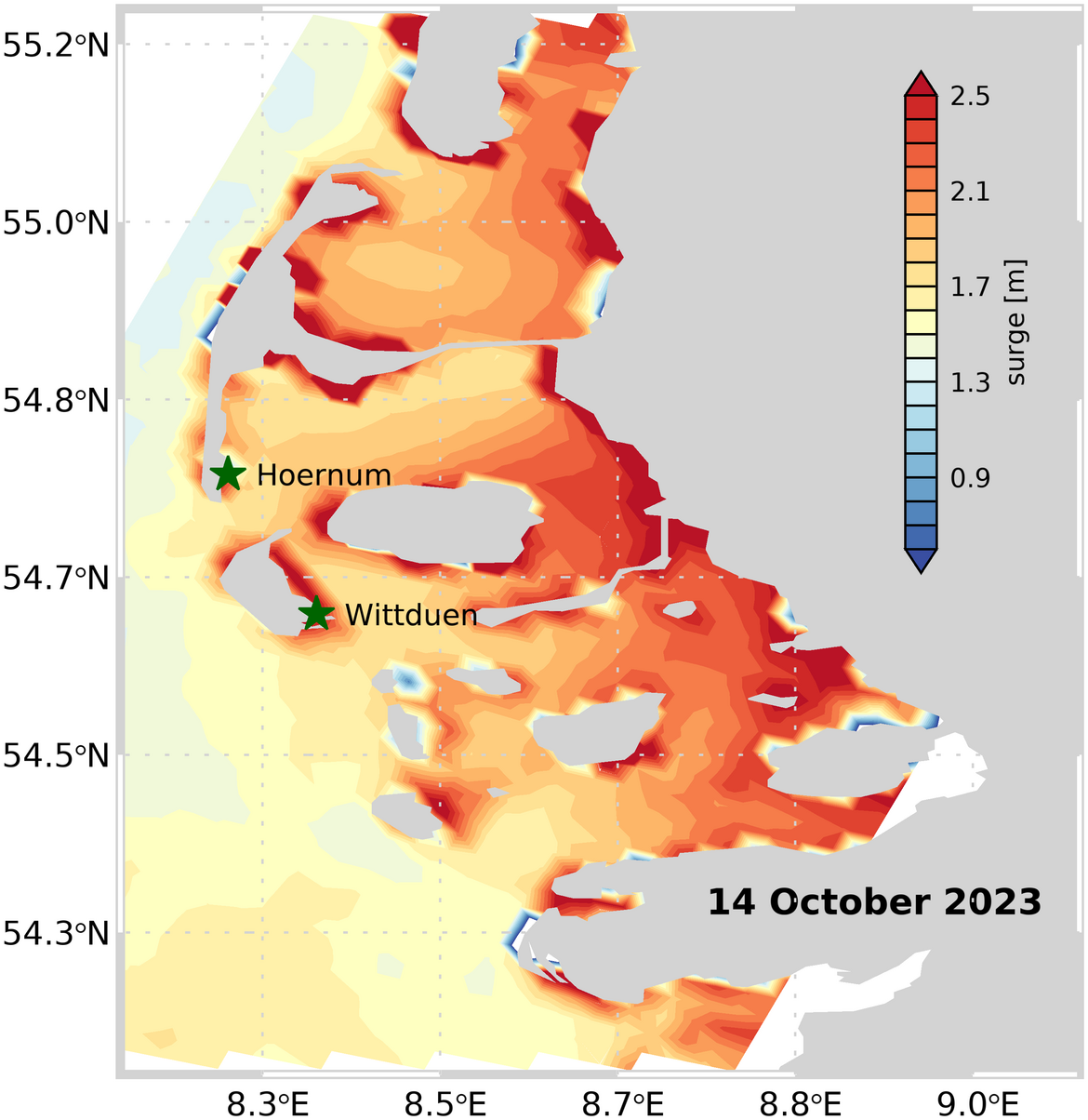
The SWOT mission provides two-dimensional sea level maps over the ocean as well as geostrophic currents derived from them. They are available with a spatial resolution of 2x2 km, in coastal waters even with a resolution of 250x250 m. In cooperation with the project partners, suitable data sets and further data processing for the observation of eddies in the open ocean and for transient processes near the coast are being explored. Initial analyses of SWOT data in German coastal waters show, among other things, details of the wind surge during a storm surge in the North Sea (see Figure 1). Further comparisons with tide gauge data are planned here. In the western Baltic Sea, the water level changes associated with an inflow of salty North Sea water into the Baltic Sea could be observed. The large-scale variations are in good agreement with measurements from classic nadir altimeters.
SWOT across the Continents
For the first time, interferometric radar altimetry enables us to observe the water levels of small bodies of water (lakes, dams) and rivers. This allows to observe the entire continental water cycle. As part of GreenCentralAsia, we are using the technology to monitor reservoirs in Central Asia, for example, and to make predictions about critical states of water availability. The information is made freely available via the SDSS data portal. We use the possibilities offered by our Issyk Kul Observatory for the further development of analysis algorithms.
Project partners:
- Geomar
- AWI
- Zentralinstitut für Angewandte Geowissenschaften (ZAIAG)
Project duration:
- Since 2020
Budget:
- CAWa-GREEN: 2020-2024
- GreenCentralAsia: 2024-2028
- Haushalt/POF IV: 2021-2027
Project-related publications:
- Esselborn, S., Schöne, T., Dobslaw, H., Sulzbach, R.: The 2023 Baltic Inflow event observed by SWOT altimetry, submitted to Remote Sensing


