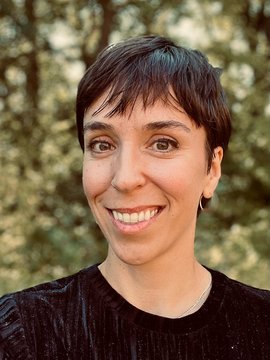
Dr.
Alison Beamish

Function and Responsibilities:
Working group leader "Technology transfer for remote sensing"
Management of the GFZ Helmholtz Innovation Lab - FERN.Lab
Earth Observation and Remote Sensing Scientist, Imaging Spectroscopy Specialist
Research Interests:
- Technology Transfer
- Knowledge Transfer
- Product development
- Sustainable & FAIR Software development
- Hyperspectral data analysis
- Field spectroscopy
- Vegetation and soil parameter retrieval
Career:
I am currently the Group Leader of the Technology Transfer for Remote Sensing Working Group and manager of the Helmholtz Innovation Lab - FERN.Lab. I have been working at the GFZ in Section 1.4 Geoinformatics and Remote Sensing since 2018, first as a postdoc in the Hyperspectral Remote Sensing Group and then in the Technology Transfer for Remote Sensing group.
Before starting at the GFZ, I completed my PhD at the Alfred Wegener Institute and University of Potsdam. My thesis looked at using hyperspectral remote sensing to characterize Arctic vegetation with a focus on phenology and biochemical properties. The effects of climate induced landscape and ecological changes was the focus of my Masters and Bachelors theses which I completed at the University of British Columbia and Queen’s University, respectively.
Education:
B.Sc.H Geography, Queens University, Kingston Ontario, Canada
M.Sc. Geography, University of British Columbia, Vancouver British Columbia, Canada
Ph.D. GeoEcology, University of Potsdam and Alfred Wegener Institute of Polar and Marine Research, Potsdam Germany
Projects:
Projekte
EO4Nature - Earth Observation for Nature-based Solutions
SAR4Infra - automated SAR-based monitoring of infrastructure hazards
SAR4KITagebaufolge - SAR-based risk assessment for mining-related infrastructure damage
AgroHyd-X - Optimization of water use in agriculture
GeoProg - Improving forecasting models and decision support systems in crop protection by integrating high-resolution Earth observation data and AI-optimized methods
POINTR - Helmholtz Imaging Project. Fusing point cloud and radar data to reveal changes in the structure of northern boreal forests and their development, in order to identify early warning signs of abrupt changes.
FERN.Lab (2020 -) Helmholtz Innoation Lab - Remote sensing for the sustainable use of resources
EnMAP - Environmental Mapping and Analysis Program (BMWK, 2010-2023, www.enmap.org)
iCUPE - Integrative and Comprehensive Understanding of Polar Environments (Horizon 2020, 2018-2020)
Products/Platforms
FernLern Wissenstransfer Plattform - Learning remote sensing – from science to application
MiSa.C Minimum Sampling Classifier
XregnetWeb service for local high-resolution precipitation data
Research Boards and Committees:
Board activities, StandardizationDIN SPEC 91506 - Determining the carbon storage in existing buildings
