Innovative Multi-disciplinary European Research training network on Volcanoes | IMPROVE
IMPROVE is a highly cooperative multi-disciplinary network of European Research Institutes and Small-Medium Enterprises. In IMPROVE, 15 Early-Stage Researchers are trained to innovative research in volcano science extending across the academia-industry bridge, and including cooperative work, leadership skills, and independent thinking. Volcano science includes from innovative monitoring and prospecting to advanced lab experiments, High Performance Computing, and Artificial Intelligence. Two volcanic areas provide ideal cases for relevant scientific advance and training-through-research: Mount Etna in Sicily, one of the most monitored volcanoes in the world and the place where to extend our understanding of active volcano dynamics; and the Krafla caldera in Iceland, site of a large geothermal circulation system largely exploited for energy production, and of a shallow magmatic intrusion which is catalyzing break-through research from all over the world.
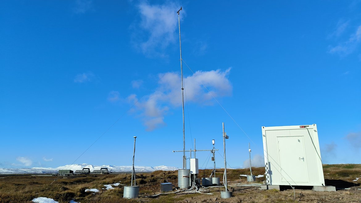
At the GFZ, we focus on Krafla and Theistareykir geothermal systems, using infrastructure from the regional observatory SMARTIES.
More Information can be found here https://www.improve-etn.eu/
Time Frame
- 2021-2025
Funding
- EU
- GFZ
Principal Investigators
Personnel
Cooperations
- Landvirkjun (National Power Company in Iceland) - https://www.landsvirkjun.com/
- INGV (Italy) - https://www.ingv.it/
What does our PhD student say?
The aim of my project is to be able to model the subsurface mass, (fluid) and energy transfer in Krafla/Theistareykir hydrothermal environments. This goal will be achieved through the analysis and integration of various geophysical and non-geophysical measurements (gravity, seismic, GPS data, meteorological data, injection/extraction monitoring in the geothermal plant and more). Furthermore, the role of anthropogenic activities in the total mass and energy displacement will be assessed. The setup of multi parameters stations equipped with gravitymeters, broadband seismometers, GPS receiver, meteorological station, hydrological sensor, camera and soil sensors to monitor the environmental conditions is therefore fundamental, in order to correctly reduce the gravity measurements and create accurate local Earth tide models.