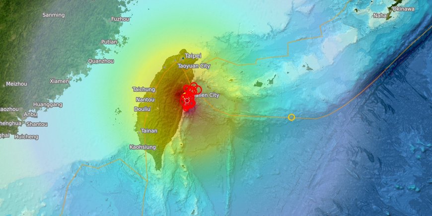
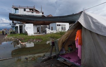
A severe earthquake with a magnitude of 7.4 shook the region around the city of Hualien in eastern Taiwan this morning at 7.58am local time (1.58am CEST). The source of the quake was located at a depth of around 32 kilometers. An aftershock with a magnitude of 6.5 followed less than 15 minutes later. Numerous other aftershocks with magnitudes of over 4 and 5 continue to shake the region. The US news channel CNN, citing Taiwanese authorities, reports nine deaths and more than 900 injuries as well as numerous people trapped in tunnels. According to CNN, two German nationals have been rescued from a road tunnel.
The island of Taiwan lies on the boundary of two tectonic plates, the Eurasian Plate in the west and the Philippine Plate under the Pacific Ocean in the east. In this region, the Eurasian Plate dives under the Philippine Plate. Because the Eurasian plate has continental characteristics, it is a collision process and the deformation is distributed. On the east coast of Taiwan, steep mountains have been folded up as a result of this process, which also repeatedly leads to severe earthquakes. The strongest of these earthquakes in the last fifty years was a magnitude 7.7 quake in September 1999: the Chi-Chi earthquake claimed more than 2,000 lives and caused damage amounting to around 14 billion dollars. The epicenter was sixty kilometers west of the quake of April 2, 2024.
According to GFZ analysis, the epicenter of the current earthquake is located around fifteen kilometers south-east of the city of Hualien offshore. There, the Philippine plate is moving towards the northwest at a speed of around 78 mm per year and is pushing against the Eurasian plate. At a depth of around 30 kilometers, rock ruptured over an area of approximately 60 by 35 kilometers. Initially, the authorities in Taiwan and other countries in the Pacific region issued tsunami warnings. These were lifted a short time later.
In addition to the destruction of buildings and infrastructure, a large number of landslides were also triggered, particularly in Taroko National Park, app. 20 kilometer north of Hualien. The GFZ operates an observatory there to monitor surface processes, in particular the interaction of tectonic and erosion processes, e.g. between earthquakes, landslides and sediment transfer in rivers.
Information on the observatory:
https://www.gfz.de/en/scientific-infrastructure/research-infrastructures/regional-observatories/taroko-earth-surface-observatory-teso
Information on earthquakes worldwide:
https://www.gfz.de/en/press/current-earthquake-information


![[Translate to English:] Fire in a forest, smoke rising, aerial view from above](/fileadmin/_processed_/8/3/csm_2025_01_06_AdobeStock_415831729_5a0e6d50d3.jpeg)


![[Translate to English:] [Translate to English:] Abror Gafurov von dem Schriftzug "Welcome to Azerbaijan" und den UN und COP Logos](/fileadmin/_processed_/2/5/csm_2024_11_Baku_COP29_Abror_Gafurov_1042faec82.jpeg)


![[Translate to English:] Martin Herold standing in front of the library on the Telegrafenberg](/fileadmin/_processed_/c/d/csm_Martin_Herold_d385ee4dd9.jpeg)
![[Translate to English:] Many people are listening to a presentation in the GFZ lecture hall.](/fileadmin/_processed_/c/a/csm_1_Bild1_hell_b9c0e9f5ed.jpeg)


![[Translate to English:] Both scientists sitting on stools in front of a wall of books in the Telegrafenberg library](/fileadmin/_processed_/6/6/csm_Buiter_Castell_DORA_4_e87cb1ea18.jpeg)
![[Translate to English:] Gruppenbild mit 4 Personen](/fileadmin/_processed_/8/d/csm_20241017_GFZ-Emmerman-Medal-005_web_reinhardtundsommer_21a414fa4a.jpeg)


![[Translate to English:] Ice landscape with five red tents](/fileadmin/_processed_/8/9/csm_Zeltlager_auf_dem_Eis_Urheberin_Jenine_McCutcheon_5ced2d523b.jpeg)