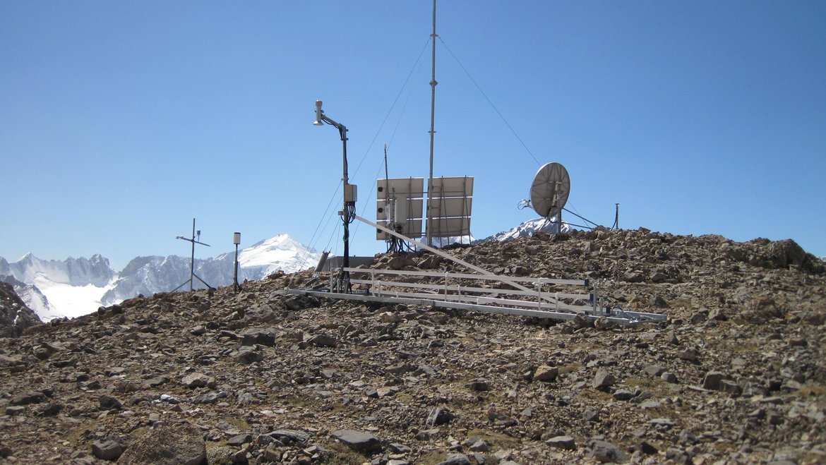
Global Earth observations require a large number of multi-parameter measurement stations (ROMPS) to record various environmental and Earth system parameters. The GFZ has developed these stations and is now using them in various climates, from -45°C to +50°C, and in different areas, from the equator to high mountain regions.
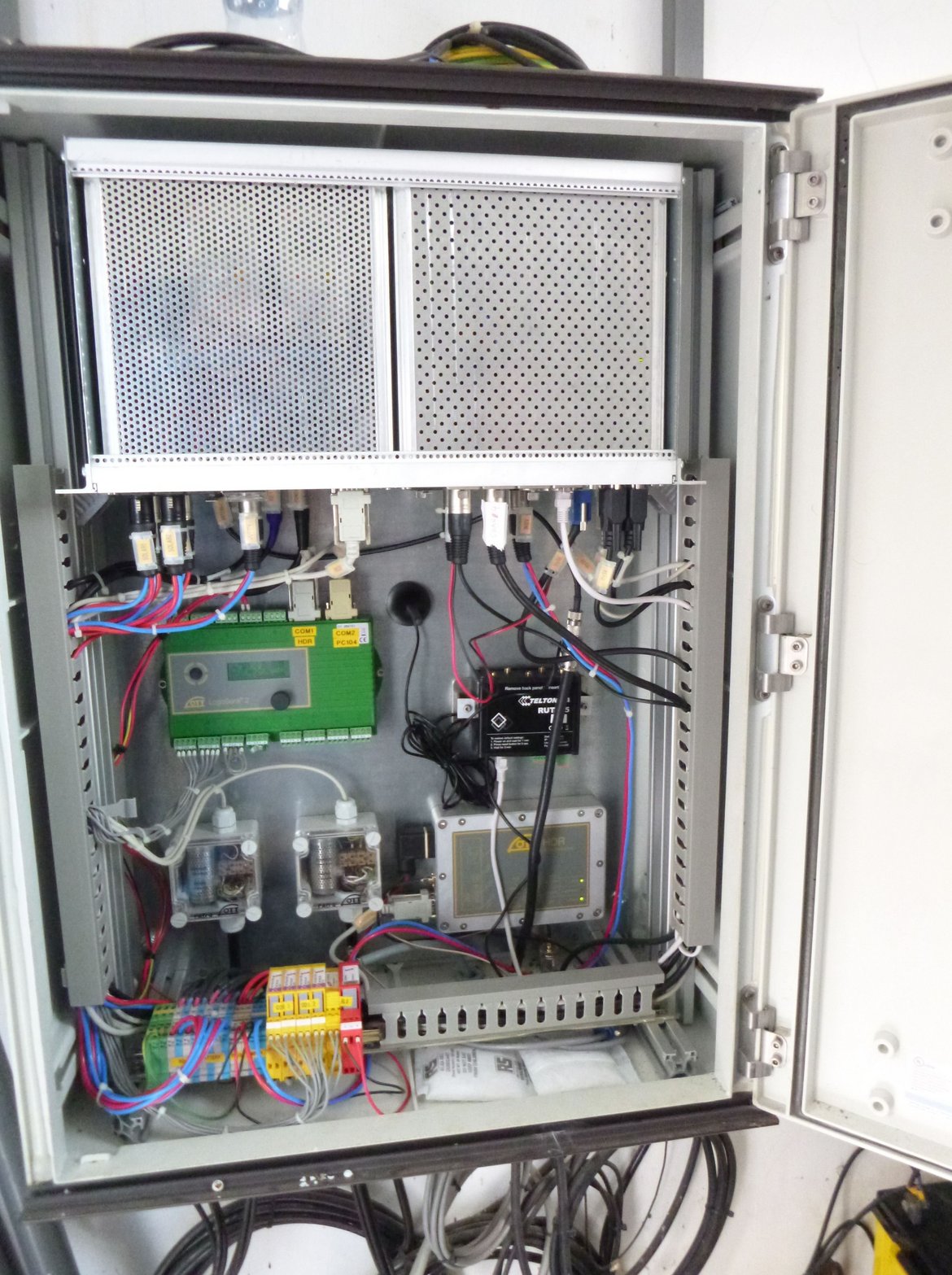
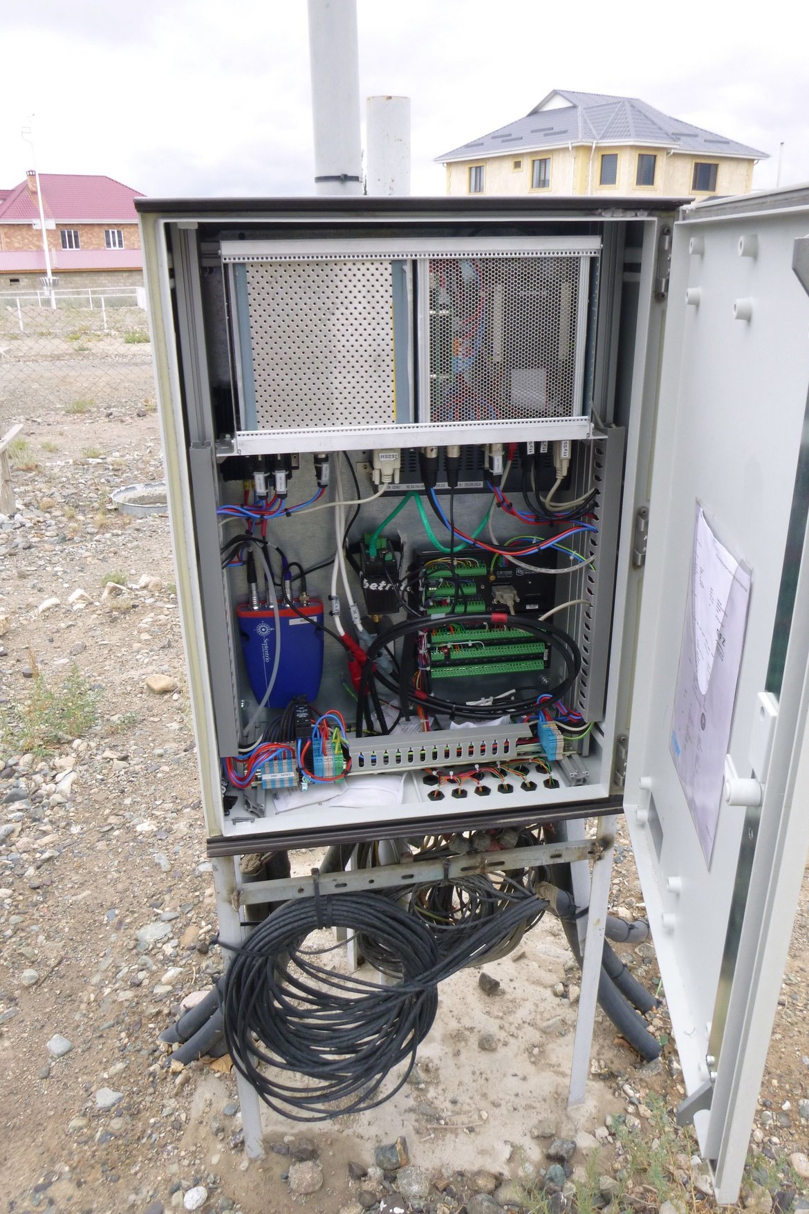
The stations are based on a simple, scalable hardware concept. It consists of a power supply module and a PC module. The PC module uses PC104 technology and runs on Linux. The station can be equipped with various communication modules, including LAN, GSM, satellite telephony, BGAN, and VSAT. Solar modules, wind generators, fuel cells, or 220V connections are used for the power supply, depending on the intended use.
The basic module is complemented with various sensors, depending on the area of application. All stations contain a geodetic GNSS receiver and various data loggers (e.g., from OTT® for tide gauge stations or from Campbell Scientific® for hydrometeorological stations). In various installations, seismometers are operated via the SeisComp3 software, cameras are used to monitor glaciers, and discharge measuring systems are used for rivers. Additional hardware can be easily integrated.
All hardware components are connected to the power supply via a battery manager. This allows for limit-controlled shutdown processes and is used for hardware reset. A large number of internally collected data (housekeeping data) enables effective station management. The station is controlled via various management software modules, which allow basic operation without interaction (failover, disk space monitoring, automated data transfers, and much more). Individual software for the connected hardware can be easily integrated.
The stations' individual components enable real-time applications (GNSS, seismology), making them suitable for use in early warning systems (Indonesia, Oman).
Project partners:
- Central Asian Institute for Applied Geosciences (CAIAG)
- GITEWS & PROTECS (https://www.gitews.de)
- Badan Informasi Geospasial (Indonesia) (https://www.big.go.id)
Project duration:
- GITEWS: 2005 – 2011
- PROTECS: 2011-2014
- CAWa: 2008 – 2019
- CAWa-GREEN: 2020-2024
- GreenCentralAsia: 2024-2028
Budget:
- GITEWS & PROTECTS: BMBF
- CAWa & CAWaGREEN: Auswärtiges Amt
- GreenCentralAsia: GIZ GmbH
- GFZ-Haushalt, Global Change Observatory Central Asia (GCOCA)
Project-related publications:
- Schöne, T., Illigner, J., Manurung, P., Subarya, C., Khafid, Zech, C., & Galas, R. (2011). GPS-controlled tide gauges in Indonesia - a German contribution to Indonesia's Tsunami Early Warning System. Natural Hazards and Earth System Sciences (NHESS), 11(3), 731-740. doi:10.5194/nhess-11-731-2011
- Zech, C., Schöne, T., Illigner, J., Stolarczuk, N., Queißer, T., Köppl, M., Thoss, H., Zubovich, A., Sharshebaev, A., Zakhidov, K., Toshpulatov, K., Tillayev, Y., Olimov, S., Paiman, Z., Unger-Shayesteh, K., Gafurov, A., & Moldobekov, B. (2021). Hydrometeorological data from a Remotely Operated Multi-Parameter Station network in Central Asia. Earth System Science Data, 13(3), 1289-1306. doi:10.5194/essd-13-1289-2021
- (Data publication) Zech, C., Schöne, T., Illigner, J., Stolarczuk, N., Queißer, T., Köppl, M., Thoss, H., Zubovich, A., Sharshebaev, A., Zakhidov, K., Toshpulatov, K., Tillayev, Y., Olimov, S., Paiman, Z., Unger-Shayesteh, K., Gafurov, A., Moldobekov, B. (2020): Hydrometeorological data from ROMPS network in Central Asia. https://doi.org/10.5880/GFZ.1.2.2020.002
- Schöne, T., Zubovich, A., Zech, C., Illigner, J., Sharshedaev, A., Mandychev, D., Shakirov, A., Stolarczuk, N., Haghshenas Haghighi, M., Gerlitz, L., Gafurov, A., Moldobekov, B., & Lauterjung, J. (2019). In Situ and Remote Water Monitoring in Central Asia — The Central Asian Water (CAWa) Network. In L. Müller, & F. Eulenstein (Eds.), Current Trends in Landscape Research (pp. 599-610). Cham: Springer. doi:10.1007/978-3-030-30069-2_27.
- Hoelzle, M., Azisov, E., Barandun, M., Huss, M., Farinotti, D., Gafurov, A., Hagg, W., Kenzhebaev, R., Kronenberg, M., Machguth, H., Merkushkin, A., Moldobekov, B., Petrov, M., Saks, T., Salzmann, N., Schöne, T., Tarasov, Y., Usubaliev, R., Vorogushyn, S., Yakovlev, A., & Zemp, M. (2017). Re-establishing glacier monitoring in Kyrgyzstan and Uzbekistan, Central Asia. Geoscientific Instrumentation, Methods and Data Systems, 6, 397-418. doi:10.5194/gi-6-397-2017.
- Schöne, T., Zech, C., Unger-Shayesteh, K., Rudenko, V., Thoss, H., Wetzel, H.-U., Gafurov, A., Illigner, J., Zubovich, A., & CeGIT Centre for GeoInformation Technology, Geoengineering Centres, GFZ Publication Database, Deutsches GeoForschungsZentrum (2013). A new permanent multi-parameter monitoring network in Central Asian high mountains - from measurements to data bases. Geoscientific Instrumentation, Methods and Data Systems, 2(1), 97-111. doi:10.5194/gi-2-97-2013