The aim of the TephroMed project (Tephrochronological synchronization of ICDP sediment cores from the Dead Sea and Lake Van in the eastern Mediterranean for the last 130 000 years) is the exact synchronization of the long sediment cores of the ICDP PALEOVAN (Lake Van) and DSDDP (Dead Sea) drilling campaigns with the help of tephra and cryptotephra investigations.
Chronostratigraphic investigation of two recently discovered dry maars of late-Pleistocene age close to Mýtina (CZ) and Neualbenreuth (DE)
Eifel Flood Event 2021 HART action EifelfloodS aims to secure and analyse airborne LiDAR and optical data and field based evidence of flood dynamics and damage condition, predominantly in headwater regions, before diffusion erases the traces.
Reconstructing abrupt climate changes during the Late Glacial from lacustrine sediments With this ERC funded project we investigate the spatiotemporal evolution of the hydrological cycle during the Late Glacial Period using biomarker isotope signatures to identify regions that are particularly prone to modern climate change.
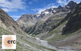
The chemical weathering of carbonate and silicate rocks in rapidly eroding mountains exerts a strong control on Earth’s carbon cycle. The aim of this project is to constrain the impact of soil and landslide erosion processes on carbonate and silicate weathering.
Perturbations of Earth Surface Systems by large Earthquakes Since the 2015 Gorkha earthquake of Mw7.9 GFZ's Hazard and Risk Team is investigating the impact of earthquakes and inter-seismic erosion in the Himalayan landscape evolution with a complex monitoring network in Nepal.
Environmental Seismology Environmental seismology is a central project cluster of the section. Seismic sensors are used to detect, locate, track and quantify geomorphic processes, from landslides and rockfalls over debris flows and fluvial activity, to the interaction of drivers and processes.
In various observatories in the European Alps and in Asia we study the processes in and around mountain channels, and how these processes shape the channel.
We monitor seismic velocity changes induced by hydrological changes and seismic damage in the shallow subsurface and investigate their interactions.
Mass wasting events are preceded by the appearance and the propagation of cracks. Identifying them in a robust and consistent way is crucial for hazard anticipation. This project use seismic signal analysis coupled to machine learning technique to retrieve crack temporal and spatial evolution.
The Da'an River gorge in western Taiwan is the result of uplift of the riverbed during an earthquake in 1999. The river is now rapidly incising which provides an ideal opportunity to study the site by means of high resolution topographic surveying.
We strive to develop centennial to millennial records of Indian and Asian monsoon dynamics using different biological and geological archives.
The mechanics of sea cliff erosion at the event-scale remain poorly understood. This project aims to quantify the role of small, cyclic stresses via wave action in modifying cliff rock strength and driving cliff erosion through the application of geophysical methods.
Long-term temperature reconstructions derived from trees growing well within their latitudinal or altitudinal limits in European lowlands are missing, which is a crucial gap in the palaeoclimate database. Therefore, the aim of the project is to establish and advance cell structure measurements as a new proxy for temperature reconstructions in the temperate lowlands of Northeastern Germany and Northern Poland.
Impacts of Climate change on Erosion rates and Hillslope processes In this set of projects, we investigate how millennial-scale climate forcing has affected local paleoclimate, and how landscapes respond with respect to erosion rates, erosion processes, and sedimentation patterns.
Landslides are the primary erosional mechanism in mountainous areas. A new methodology for quantifying long-term landslide rates and contributions to sediment fluxes is developed, by using analyses of cosogenic radionuclides in combination with detailed field surveys.
Stone pavements are widespread surface features in deserts globally. They are the result of the deposition of dust, not erosion. They can form continuously thickening recorders of the environmental conditions during which they formed.
The significance of organic carbon in the global carbon cycle Oceans are important long-term sinks of organic carbon. With ROCcycle we quantify the amounts of fossil and modern biospheric carbon exported through major river systems and investigate effects of tectonic and surface processes as well as extreme rainfall events.
Within the framework of the research project PALEX (Paleoclimate in the Eastern Mediterranean Region – Levante: Paleohydrology and Extreme Flood Events) sedimentologists, hydrologists and geochemists from Germany, Israel and Palestine are carrying out joint research. Model scenarios for the Dead Sea region predict increasing drought with progressing global warming. This would affect millions of people living in this region.
Theme of the Virtual Institute for Integrated Climate and Landscape Evolution Analyses ICLEA is the better understanding of the Dynamics of Climate and Landscape Evolution of Cultural Landscapes in the Northern Central European Lowlands since the Last Ice Age.
The high-resolution multi-proxy study at the unique geoarchive of the Tayma palaeolake or sabkha, respectively, will generate records of climate-, landscape-, and settlement-related parameters including microfacies distribution, mineralogy, magnetic susceptibility, inorganic and organic carbon and nitrogen, stable isotopes, element contents, micro- and macrofauna, diatoms, lipid biomarkers, pollen and 14C dating.
The aim of the DFG project PRO-HYDRO is to trace back the sediment sources of the annually laminated sediments archived in the Dead Sea. Tracing sediment sources can uncover the sediment contributions of the large perennial Jordan River and smaller contributions of Wadi Systems that are mostly active during extreme precipitation events (flash floods).
Within the frame of the international geoscientific graduate school for geosciences StRATEGy (IGK2018; funding by German Science Foundation DFG und the state of Brandenburg) we investigate two lake sediment profiles in the Andes in NW Argentina together with our partners from Jujuy University.
To comprehensively understand the impact of rapid climate change in the southern Baltic Sea region and to distinguish between natural and human forcing, the BaltRap network (coordinated by the IOW Leibniz-Institut für Ostseeforschung Warnemünde) aims at integrating high-resolution marine (Baltic Sea sediments) and terrestrial (lake sediments and tree rings) proxy archives.
The aim of the BMBF project PalMod is a transient simulation of global climatic changes for the complete last Glacial-Interglacial cycle, i.e. the last 130.000 years. Palaeoclimate data from different proxy archives will be used for validating the modelling results. Within the PalMod work package WP 3.2, which is coordinated by GFZ Section 4.3, existing high-resolution palaeoclimate datasets will be compiled, synchronized and evaluated with regard to climate sensitivity and chronological uncertainties.
An exceptional discovery of 256 individual pine trees within the town of Zürich in 2013 (referred to as the BINZ material), for which first radiocarbon dates now suggest a time window roughly between 14 000 and 11 000 BP, implies strong evidence to fill existing gaps in the Late Glacial tree-ring chronology around 12 500 BP.
Africa is very likely to warm more than global average during this century. Especially (semi-)arid regions are endangered to experience particularly high warming and possibly catastrophic droughts. The prediction of the climate change impact on these regions requires information about the past climate conditions in high temporal and spatial resolution. There is a massive lack of transregional highly time resolved climate proxy data for the African continent.
The overall projective of CAHOL is the reconstruction of the Holocene climate, with special focus on tipping points, from continental and marine archives to better understand the driving mechanisms of abrupt climate changes and the interaction between the monsoon and west wind climates. CAHOL is part of the BMBF research program CAME II: “Crossing climatic tipping points – consequences for Central Asia“.
In the PALESCA project, local actors in close cooperation with scientific and governmental institutions assess critical environmental changes and develop approaches to solving problems at two focus sites in Kyrgyzstan.
INTegrating Ice core, MArine, and TErrestrial records – INTIMATE: INTIMATE is an open network for all interested scientists working on palaeoclimate reconstructions in the period 60,000 to 8000 years ago.
Several joint expeditions by Russian, American, and German scientist mainly in 1998, 2000, and 2003 revealed that the sedimentary record of 12 km wide lake El'gygytgyn (Chukotka Peninsula, Northeast Siberia) filling a meteorite impact crater, has a high potential for a long-term paleoclimate study. Sediment cores were drilled 2008/2009 during an ICDP campaign.
PROGRESS stands for "Potsdam Research Cluster for Georisk Analysis, Environmental Change and Sustainability". It is a joint research project subsidised by the German Federal Ministry for Education and Research (BMBF) within the framework of „Advanced Research and Innovation in the New Federal States.
The joint research project CADY - Central Asian climate DYnamics aims to reconstruct the Holocene climate variability and regional hydrology in Central Asia along three transects on the Tibetan Plateau. CADY is part of the BMBF research program "Central Asia and Tibet: Monsoon dynamics and geo-ecosystems".
The EU-INTAS/DFG/ Project CLIMAN and a NATO project brought together a multidisciplinary team of scientists, including physical oceanographers, chemists, biologists, palaeoecologists, sedimentologists, geographers, and archaeologists.
DecLakes, a project within the ESF Eurocores EuroCLIMATE program, will provide six well-dated high-resolution records of the oxygen-isotope composition of past precipitation derived from ostracods in the profundal lake sediments from the Northern, Western and Southern margin of the Alps and from North-eastern Poland.
Varved lake sediments have been recognised as key archives for palaeoclimate reconstruction on the continents.
Investigations of the East Asian monsoon system over the last glacial-interglacial cycle are based on sediments of small lakes with high sedimentation rates from South- and Northeast-China. Main aspects of palaeoclimatic reconstructions are variations of precipitation and dust flux, as well as vegetation dynamics.
The Near East region encompasses a unique set of contrasting environments, where changes in hydrological regimes are probably the most prominent expressions of climate variability. Environmental changes in this region had a profound impact on prehistoric and early historic cultural evolution of mankind.
Pollen and diatom assemblages from annually laminated lake sediments record vegetation and environmental histories.
Lake Baikal represents one of the few Eurasian, continental, lacustrine sites with an extremely long, uninterrupted sedimentary record (spanning potentially 25 million years) that has been exploited for high resolution palaeoclimate studies.
Oscillating between lacustrine and marine stages during the Late Quaternary, the Black Sea holds unique sedimentary archives with potential for high-resolution paleoclimate reconstructions.
The palaeolake deposits of Piànico (Southern Alps, Bergamo, Italy) include a continuous succession of ca 15,500 exceptionally preserved calcite varves that formed under peak interglacial conditions.
The ESF EuroCLIMATE project CHALLACEA aims to provide a continuous high-resolution multi-proxy record of temperature and moisture-balance variability in equatorial East Africa from the Last Glacial Maximum (25 ka BP) to the present.
Within this project in cooperation with the CNR institute for ecosystem research (ISE) in Pallanza spatial patterns of sediment deposition related to major flood events are investigated.
Annually laminated sediment sequences along a transect from the Cariaco Basin (off Venezuela) across lakes in East and Central Mexico to the Pacific coast are ideal archives to study Holocene rainfall distribution in Mesoamerica, determined by ITCZ dynamics.
Sediment cores from the Tswaing Crater are one of the few long continental climate archives of southern Africa. They are used to unravel the southern hemisphere climate history of the last 200 ka.
Arctic marine sediments turned out to ideal recorders of geomagnetic field variations such as short reversal excursions
Stratigraphy, from Latin stratum + Greek graphia, is the description of all rock bodies forming the Earth's crust and their organization into distinctive, useful, mappable units based on their inherent properties or attributes in order to establish their distribution and relationship in space and their succession in time, and to interpret geologic history.
Tree ring parameters like ring width, wood density and stable isotope ratios have been used for a long time in areas outside the tropics as powerful tools for the retrospective analysis of tree growth and its response to environmental factors.
This project funded by the International Bureau of the BMBF studies „Past and Present Response of Woody C3 and C4 Plants to Climate Change using Sophora chrysophylla (C3) and Euphorbia olowaluana (C4) trees in Hawai`i, USA“
The use of confocal laser scanning microscopy CLSM in quantitative wood anatomy as a novel advance for developing long chronologies of wood cell structure measurements.
The project aimed on a Holocene palaeoenvironmental and palaeoclimatic reconstruction for the western margin of Europe on the basis of the lake sediment record of the brackish karst Lake An Loch Mór (Island of Inish Oirr, Galway Bay).
![[Translate to English:] [Translate to English:] Logo EnvSeis](/fileadmin/_processed_/a/0/csm_env_seis_logo_540x340_v2_88ff8e21ae.png)


![[Translate to English:] Suphan Vulcano, Turky](/fileadmin/_processed_/4/c/csm_Suphan-tile-w-logo_0501943404.jpeg)
![[Translate to English:] [Translate to English:] Logo Csponge](/fileadmin/_processed_/b/1/csm_csponge-logo-v2_46c5ff0e6e.png)
![[Translate to English:] [Translate to English:] sdsds](/fileadmin/_processed_/2/6/csm_Rain6K_1_fa7e4532c8.jpeg)
![[Translate to English:] View of the Dead Sea shoreline, Jordan](/fileadmin/_processed_/f/4/csm_Warm_1-small-w-logo_2329cefe29.jpeg)

![[Translate to English:] Logo 8kaDynamics](/fileadmin/_processed_/e/7/csm_82ka_event_kachel_0a6587b386.png)
